You are hereBlogs / John Kounis's blog / Memorial Day in Montana - Day 4
Memorial Day in Montana - Day 4
Click here to read about day 3 of this adventure.
The "afternoon and evening thunderstorms" I had expected turned out to be stronger and more persistent than forecast. Rain pelted the tent the entire night, resulting in mud patches and puddles in the campground. A check of XM weather revealed that the heavy rain would abate for a couple of hours between 10 a.m. noon, and then return with a vengance and hang on for the next couple of days. We decided that the best course of action was to make an escape as soon as the weather permitted.
There was some stress in the group as the bad weather stubbornly hung on, and it was still marginal at noon. Fortunately, the weather did end up clearing by around 2 p.m. As soon as the skies cleared, a big-tired Maule landed to pick up his friends, our campsite neighbors the bear hunters. The pilot had seen the same forecast as we had and wanted to get his friends out of the backcountry before they got trapped for a few more days.
I made a test flight around the local area to assess the weather and aircraft performance prior to loading all our gear. The weather was good at takeoff, but it was raining moderately when I landed 7 minutes later. This demonstrates how variable mountain weather can be.
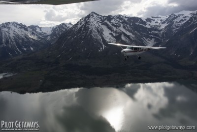
By the time we departed, the weather had improved to scattered to broken clouds between 7,000 and 9,000 feet (about 2,000 to 4,000 feet AGL), with scattered rain showers and virga. Even though it was not perfect VFR, showers and clouds made for stark mountain scenery. Our route took us north, down the Middle Fork of the Flathead River, through the Great Bear Wilderness to Glacier National Park. We were following a river downstream, which is the safest way to fly in the mountains. A river will never go through a tunnel or flow uphill into a dead-end canyon. To the left and right, we could look up narrow, glacial valleys to frozen lakes, deep blue glacial lakes, waterfalls, ice fields, and glaciers.
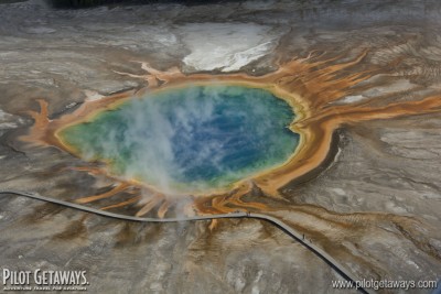
Our fuel and lunch stop at Kalispell City Airport was brief, to allow us time to escape the weather coming in from the west. We made it out just as the first rainshowers were approaching the field. The rain pushed us a little east of a direct route back to Los Angeles, taking us through the Tetons and Yellowstone National Park, both of which offer some of the best aerial scenery in the area. The Grand Prismatic Spring in Yellowstone National Park shone with bright blues, reds, and oranges despite the cloudy skies above. And the Tetons rising to almost 14,000 in the clouds, dwarfed our airplanes with an impressive sense of scale.
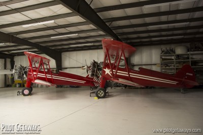
What can be better than friend who has a ranch less than 50 nm west of the Tetons? A friend with a ranch and a grass airstrip (and a free bed for the night) 50 nm west of the Tetons. Jane and Bob Hoff are just such friends. They are potato farmers who graded and planted grass on 2,500 feet of his fields to make one of the smoothest grass strips I have ever landed on. After our scenic flight of the Tetons, we landed at the Rainbow Ranch Airport, where they rolled out the red carpet. Bob and Jane are both avid pilots who also own the Aero Mark FBO in Idaho Falls, and they love the company of fellow pilots. We spent the rest of the evening admiring Bob's impressive automobile and airplane collection, including two Stearman aircraft, a Staggerwing, a Husky, and a Cessna 120.
Click here to read about day 5 of this adventure.


