

You are hereBlogs / John Kounis's blog / Memorial Day in Montana - Day 5
Memorial Day in Montana - Day 5
Click here to read about day 4 of this adventure.
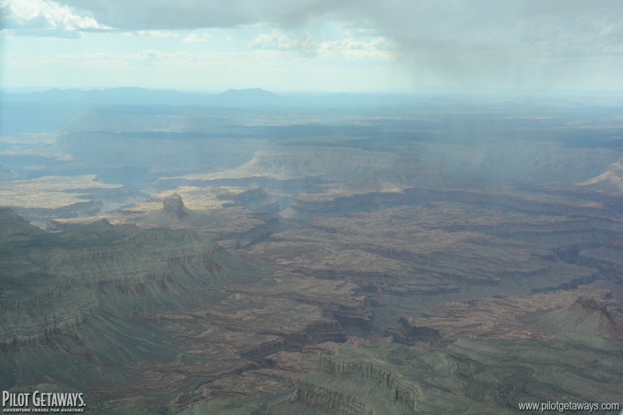
The last day of our trip was dominated by flying—lots and lots of flying—to circumnavigate weather, and to get Caroline home in time for a 7 a.m. meeting she had the following day. Again, the weather approaching from the northwest pushed us eastward, fortunately toward more scenic terrain.
We took off from Idaho Falls under clear skies, but soon encountered an overcast deck at about 8,000–9,000 feet with scattered rain showers and visibility down to 5 miles. Although that may seem like a high ceiling, most of peaks along the route are between 9,500 and 11,500 feet, meaning we were confined to the valleys. Departing Idaho Falls, we proceeded direct to Tigert Airport in Soda Springs, Idaho. From there, we followed U.S. Highway 30 about 45 nm to Cokeville Airport in Wyoming. With surface elevations of 6,000–6,500 feet and the peaks around us shrouded in clouds, this was perhaps the most challenging leg of the trip. Ramona was not familiar with the area, so she clung to my left wing like a little duckling following mama duck through the clouds.
The end run around the front worked. After Cokeville, the coulds became increasingly more scattered and the ceiling rose to 10,000, then 12,000, then 14,000 feet. Flying south out of Wyoming across Utah, we were enjoying the dry air that comes from being in the rain shadow of the mountains. Unfortunately, the drying of the air comes at a cost: As the air dries, it heats and accelerates. Wind gusts were up to 30 knots, and the turbulence was continuous.
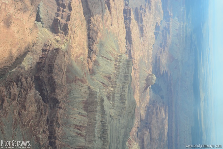
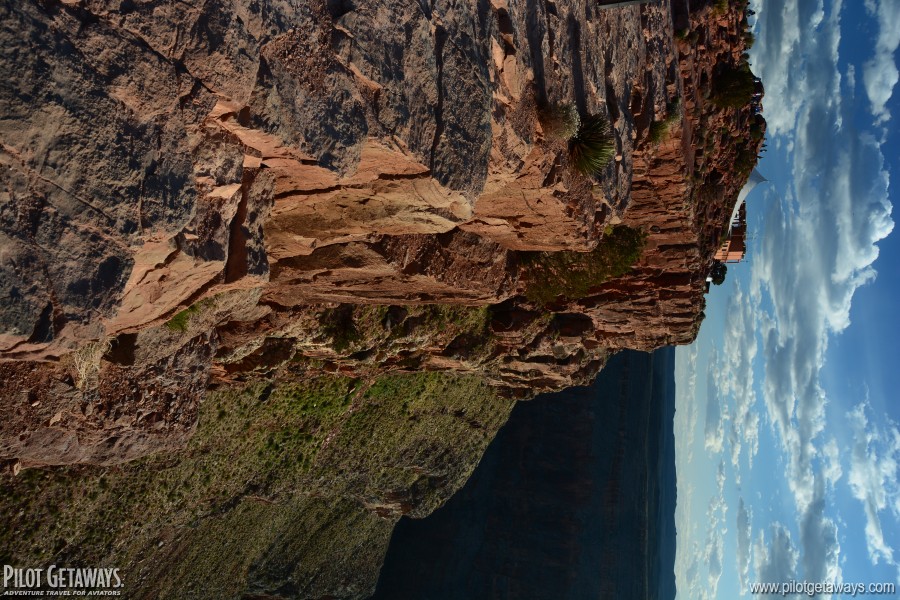
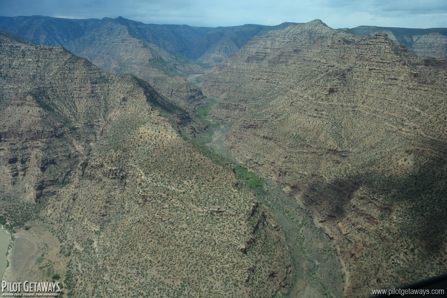 The Uinta Mountains rise well over 13,000 feet in northern Utah, so we diverted around the east side of the mountains. This also happened to be the downwind side, resulting in continuous light turbulence. From the Vernal, Utah, area near Dinosaur National Monument, we picked up the Green River and followed in through the deep canyon it carves into the 10,000-foot Tavaputs Plateau. The tall, sculpted red rock cliffs revealed eons of geological history etched into their faces.
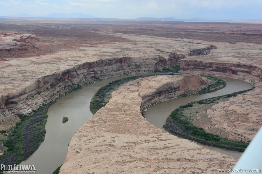
Farther south, the Green River begins its meandering path toward the Colorado River, forming the famous bends, sometimes winding more than 180 degrees, through narrow canyons.

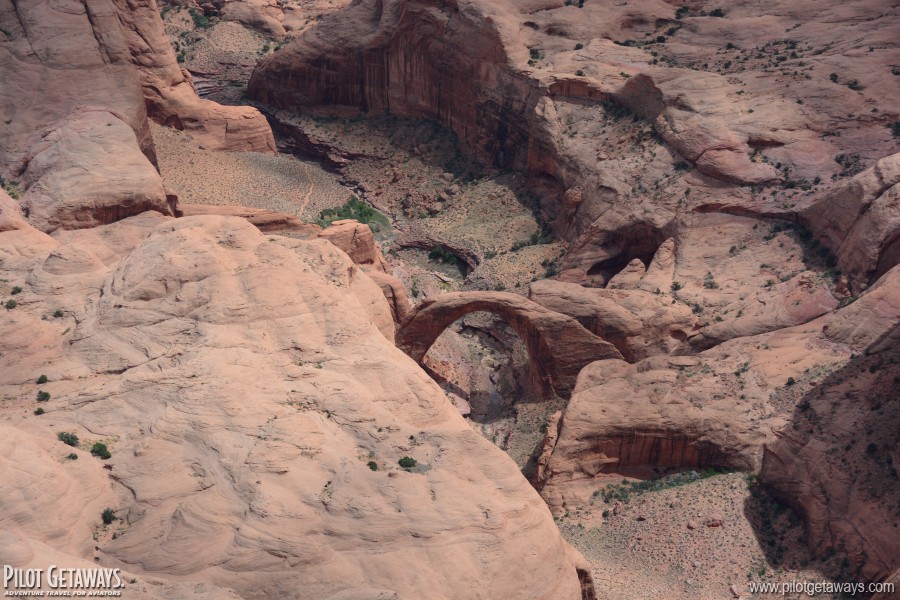
On a sandbar in the canyon bottom, the Mineral Canyon Airstrip [featured in our Winter 2001 issue] is one of the most scenic places in the area for a stop. The tiedown area is just feet from the river bank, and imposing red rock walls tower over the airport. We descended into the canyon for a closer look, but the turbulence became much stronger due to the abrupt terrain. Items were jumping around in the cabin when we hit the stronger bumps, and making a precision landing on a 2,000-foot dirt runway was out of the question. Ramona followed us into the canyon, and had a hard time climbing back out of the canyon due to her 500 lbs. of camping gear on board. During the climbout, we lost sight of each other and it took some fancy work with a GPS for us to find each other again.
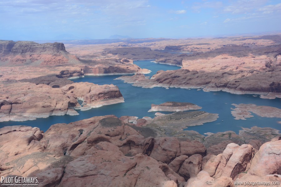
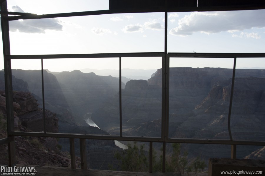
 The farther southwest we flew, the stronger the turbulence became. By the time we reached Lake Powell, the vast manmade lake formed by filling Glen Canyon, it had become quite tiring. We circled Rainbow Bridge National Monument at 2,000 feet and got a few clear pictures between the bumps.
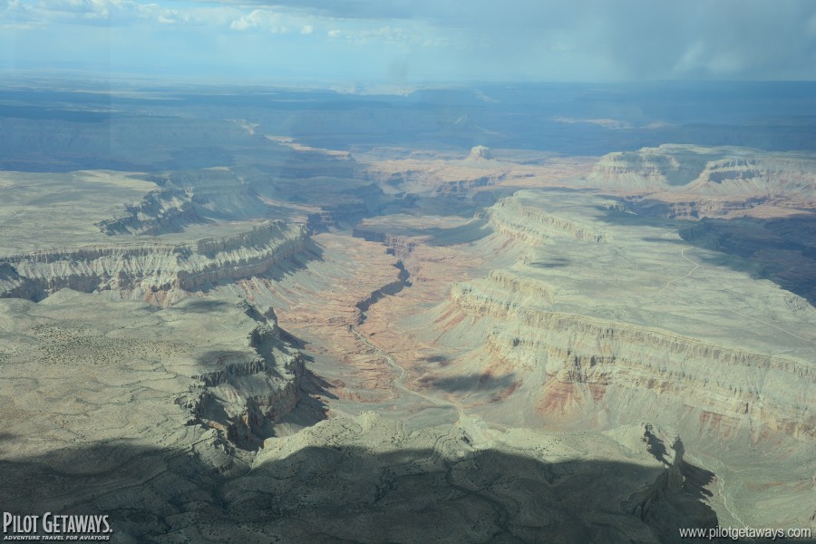
Ramona and Dave called it quits soon after our fuel stop at Page Municipal Airport in Arizona. We continued through the Tuckup Corridor at 10,500 feet. This is probably the second most scenic way to transition the Grand Canyon Special Flight Rules Area. (The Dragon Corridor about 15nm southwest is probably the most scenic and runs closest to the South Rim visitor center and national park attractions.)
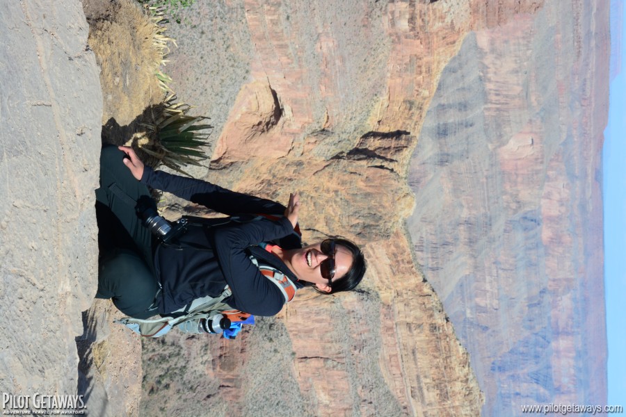
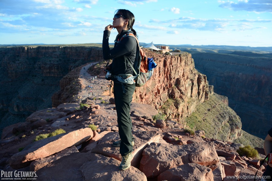
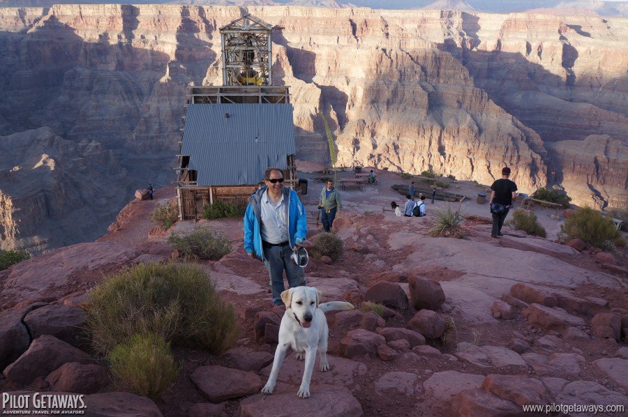
 Although many visitors to the Grand Canyon fly to Grand Canyon National Park Airport, there is an airport that makes for a convenient quick stop with an incredible view. Grand Canyon West Airport, 81 nm west of Grand Canyon National Park Airport, is a 5,000-foot runway at 4,775 feet elevation. This airport, run by the Hualapai Tribe, provides access to the Grand Canyon Skywalk, a glass platform that extends 70 feet out over the Grand Canyon. You can walk out onto the platform and look down nearly 4,000 feet at the Colorado River between your toes—if you dare. (People have been known to freeze from fear on the platform and need to be carefully coaxed back to Terra Firma.)
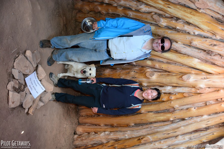
We departed Grand Canyon West in the waning hours of dusk and flew the remaining distance to Los Angeles along Interstate 15. In 4 1/2 days, we had seen 5 states and traveled more than 2,000 nm. In just an extended holiday weekend, we were able to camp in the Bob Marshall Wilderness of Montana, fly over Glacier National Park, Yellowstone National Park, Grand Teton National Park, and Grand Canyon National Park, spend the night at a friend's potato farm, and hike the Grand Canyon. It's trips like these that demonstrate the true value of general aviation and enable pilots to experience a diverse range of adventures that would otherwise be impossible with the limited schedules most people have.
Photos

|

|

|
|
|
|
|
|

|

|
|

|
|

|
|

|
|
|
|
|