You are hereMoose Creek - Flying There2
Moose Creek - Flying There2
| Pilot Getaways - Moose Creek, ID | | Previous | Next | Home |
Flying There (...continued) |
|
As you descend below the mountain ridges you lose a usable natural horizon, so you must obtain attitude awareness from your instruments and aircraft feel. It is also imperative to stay on the right side of the canyon as if it were a two-lane highway. Announce your position on the multicom frequency of 122.9 MHz after entering the canyon and periodically thereafter. You will not be able to see the airport and traffic pattern area until you get there, and you certainly don't want your airplane becoming too familiar with strangers.


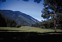
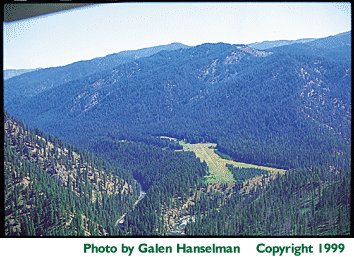
The airport is located where two deep canyons converge. The elevation of the airport is 2,454 feet, but the mountain ridges you will be maneuvering between during your descent and traffic pattern reach 6,000 - 7,000 feet. If you are not used to the feeling of looking up-way up-at terra firma all around you, it may be difficult to continue descending deeper into what feels like the bowels of the earth. As those rugged walls of granite keep squeezing you ever tighter with no airport yet in sight, you may subconsciously slow your descent and find yourself circling over the field to throw surplus altitude out the window.
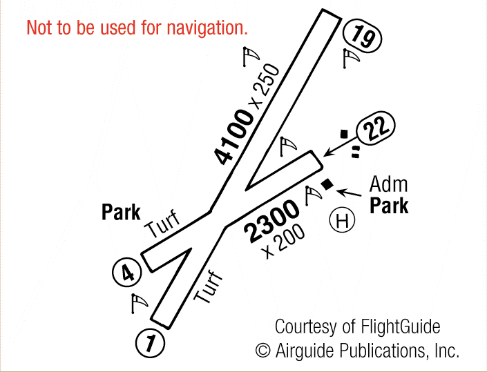
Be sure to slow to pattern speed before you arrive at the field, since any excess speed noticeably increases your turning radius and a slower speed will help you stay ahead of the airplane. Turning to keep the airfield on your left and hugging the hill on your right lets you check the windsock, and puts you on downwind for Runway 19 or what serves as upwind for Runway 4. If using Runway 4, your downwind leg will bend to the right following the Selway River downstream. Continue downstream a few miles until the canyon widens before turning around. Then descend on a long final for Runway 4.
Despite what your primary instructor may have said, with canyon flying, it is okay to turn as needed on the final approach. It is more important to maintain a reasonable descent profile than to try to intercept an extended runway centerline by staying high. Take care not to drag the plane in from a low, flat approach as you near the bluff at the threshold of Runway 4. This is where the winds of the two canyons come together making them unpredictable. Remember, airplane propellers don't make good posthole diggers. After landing, you can park your plane either by the campsites on the Moose Creek side at the crux of the two runways or up by the ranger station.
Feature Article: Moose Creek, ID, by Martin Stentzel

Page 1 ............... Main Page / Intro
Back to Pilot Getaways Home Page
Page 2 ............... Flying There
Page 4 ............... History
Page 5 ............... What to Do
Page 6 ............... Conclusion


 Moose Creek USFS
